
Hargitai “card index”
What do the data say about a county?
The same as a card index does about a person—everything and nothing. They flash the essence, but only point to what is unique and intangible.
About Harghita County we can write that it is located in Romania, in the eastern part of Inner Transylvania; it is no secret either that its area is 6639 square kilometers, with a population of 310867 in 2011.
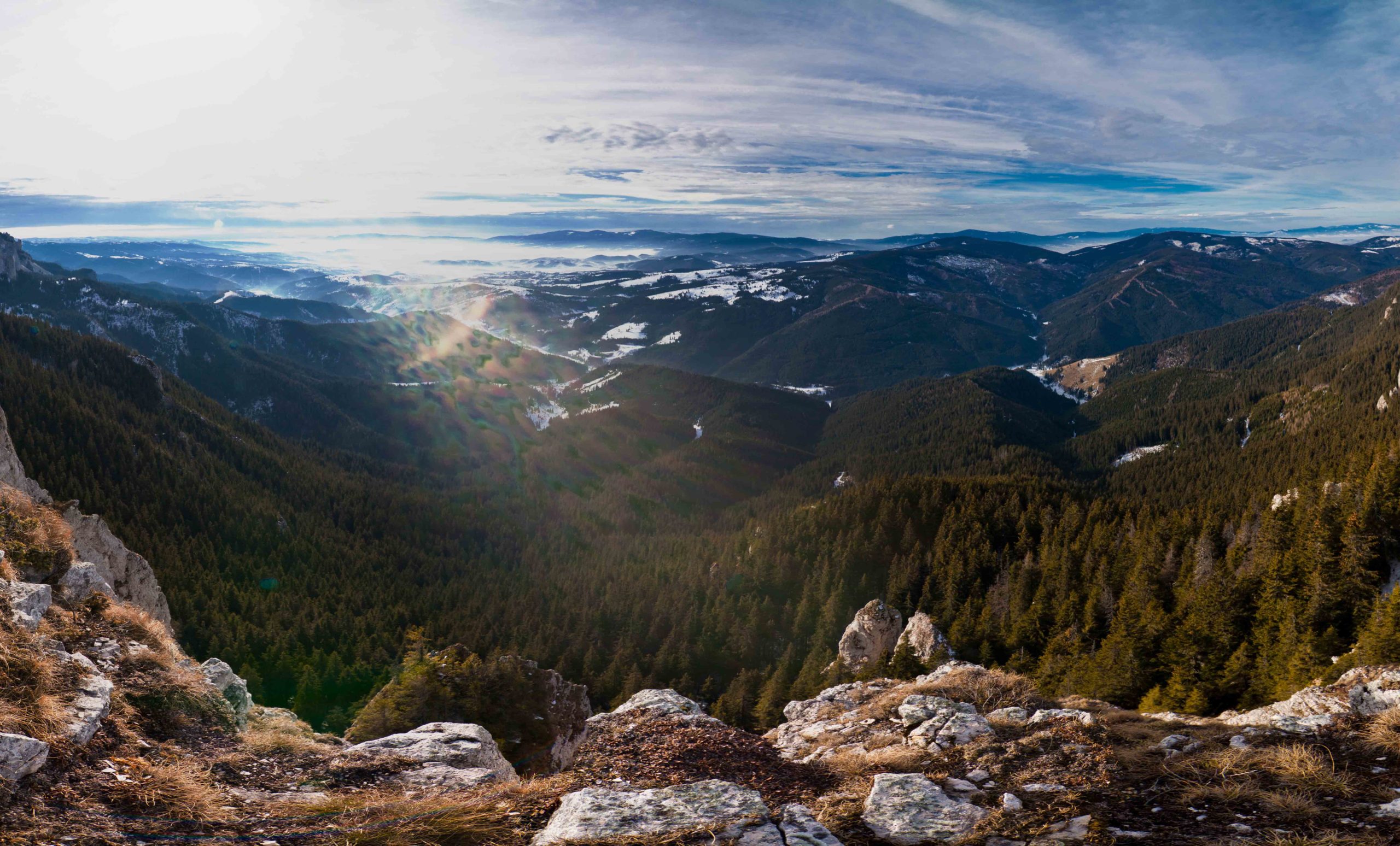
It is customary, as card-index data, to list its 9 towns—4 of them municipalities—its 58 communes, and its 236 villages. When it was established in 1968, its chosen name was not ancient, yet it refers to the Harghita Mountains, where the county’s second-highest peak rises (Madarasi-Harghita, 1801 m); the highest peak as well, Rekettyés (Călimani Mountains, 2021 m), rises only slightly above that.
From here we can already descend into the depths, for even if the mountain range forming the county’s backbone—and the central group of the Eastern Carpathians marking its eastern border—has further peaks, the western part of the county is made up of gentler, rolling hill country (Udvarhely). Moreover, an important thread in the county’s life is the “Székely chain of basins,” which, from north to south, fits into a unified whole with ever more spacious basins along the Bélbor–Borsec–Gyergyó–Csík line.
Harghita County is at once gentle and harsh, depending on where one lives—closer to the sky or farther from it, within the gravitational pull of economic and social hubs, or sustained by the sparser but purer air of wise seclusion. Its climate can be described as temperate continental; winds usually blow from the west, yet Romania’s cold pole is also found here: Gyergyóalfalu, while Miercurea Ciuc at times competes for the primacy of −40°C, with alternating chances. Snow often lingers for 120–150 days, so the water balance is very rich. On the one hand, the sibling rivers rising within easy reach—the Mureș and the Olt—and on the other, the livable valley belts formed along the Târnava and Homorod rivers make this corner of the country attractive and sustaining.
Owing to the volcanic origin of its mountains, alongside extraordinary natural beauties—such as Lake Saint Anne, a crater lake in the Ciomad, or the Mohos peat bog—its hundreds of mineral water springs, together with its human reserves of value, are all riches that remain sources of local self-awareness and legendary Székely pride to this day. This is complemented, with its own history and scenery, by Lake Roșu (Red Lake) and its surroundings, offering on a platter the blessings of hopes invested in tourism for the region.
It does not lack flora and fauna, yet the rural climate of Harghita treats cultivated crops somewhat harshly; due to relatively little sunshine, a good portion of vegetables and fruits travels to the county’s markets from gentler, more generous regions. Potatoes, however, remain faithfully at the side of the people of Harghita and, as a useful barter good, not infrequently help out in times of need.
According to the eternal law of give and take, Harghita County gladly hosts its visitors, shares its natural and cultural values with them. The several hundred listed monuments can be admired and appreciated—indeed, even preserved—pleasant memories can be gained from its thermal baths and health resorts, lasting impressions from its customs and traditions, its cuisine—very tasty even in its simplicity—and from Székely hospitality.
The drive to create value is gaining ever more ground on both sides of Harghita; alongside technical progress, science, and the many indispensable challenges of the modern age, wood, construction raw materials, clay, and salt still represent this region’s “trump cards.”
It is in the nature of a card index that the data sheet fills up quickly; renunciation of completeness is already lodged in the text at birth. Yet every datum and sign finds its place in it with the hope that, behind the images lined up in the volume, the promising face of the Harghita people’s livable everyday life will come into view.